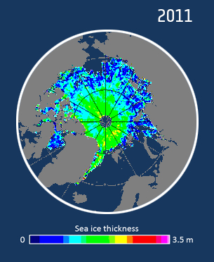
Arctic sea ice from CryoSat
Arctic sea ice time series display the change over time in sea ice thickness or volume over the whole Arctic, an ocean basin, or thickness at a point location.
Near real time data on Arctic sea ice is also available on the website within two days of CryoSat-2 passing over the ice.
Ice velocity
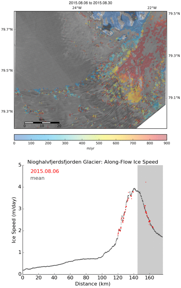
Our ice velocity data portal provides frequent maps of ice velocity for key outlet glaciers of the Antarctic and Greenland ice sheets in near real time. The velocity maps are produced by tracking moving features in Synthetic Aperture Radar data acquired by Sentinel-1.
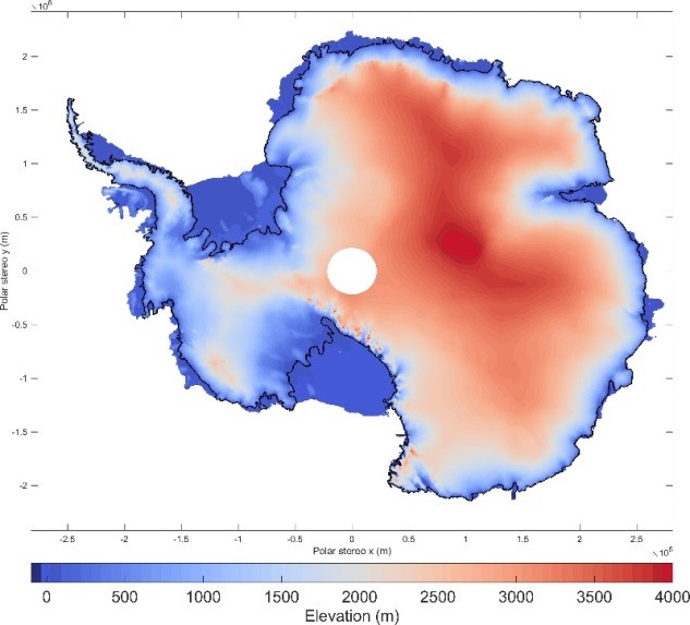
Antarctic Surface Elevation Change (SEC) from satellite altimetry
This provides elevation change in an Antarctic region or drainage basin. You can choose results from a specific satellite mission or period. The page has been recently updated to include new Antarctic 25 year elevation trends and mass change timeseries data.
We also provide datasets on glacier grounding lines which are a key indicator of ice-sheet instability. Changes in position reflect imbalance with the surrounding ocean and affect the flow of inland ice.
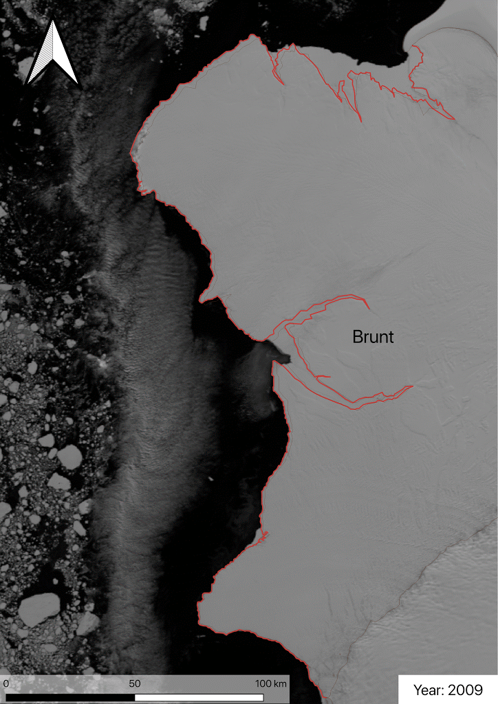
Ice shelves
We have mapped the historical calving front positions on 9 major ice shelves in Antarctica. Historical calving fronts have been manually delineated from NASA Modis satellite data over the last 10-years, and using the ESA-EU Copernicus Sentinel-1 radar images during the present day.