
Supervisors: Dr Anna Hogg; Professor Andy Shepherd
Partners: Centre for Polar Observation and Modelling (CPOM); European Space Agency (ESA); School of Earth and Environment (SEE), University of Leeds
Contact for enquiries: a.e.hogg@leeds.ac.uk
Application deadline: 15th February 2018
PhD start date: 1st May 2018 (negotiable)
Link to School of Earth and Environment PhD advertisement
Funding for this project is linked with the European Space Agency’s Support To Science Element (STSE) programme. The 3 years funding award will pay UK/EU tuition fees and UK research level stipend (£14,510 for 2017/18).
Project Summary
This project offers an exciting opportunity to work at the interface of climate and space science, making an important contribution to international efforts to study the effects and impacts of climate change. Importantly, it is likely to include a field campaign on the Greenland Ice Sheet to undertake vital work to ensure that future estimates of ice loss are correct.
Based within the Centre for Polar Observation and Modelling (CPOM), the project will be co-funded by the European Space Agency (ESA). As a result there will be opportunities to attend international ESA meetings and engage with a wide range of scientific collaborators.
During this project you will use Earth Observation data acquired by satellites such as ESA’s CryoSat-2 to assess how the Greenland and Antarctic ice sheets are contributing to sea level rise (SLR), and how this sea level contribution varies spatially and temporally across the globe. This will be achieved by exploiting super-high resolution satellite observations of surface elevation change, generated using the novel ‘swath mode’ processing technique.
In addition, you will collect field data and use it to validate satellite measurements from CryoSat-2, ESA’s satellite mission dedicated to monitoring the polar regions. This is needed to assess how CryoSat-2’s measurements are distorted by climatic extremes, and therefore to improve current estimates of ice loss and its corresponding SLR contribution.
Background
Knowledge of glacier and ice sheet topography (and its change over time) is a basic parameter of glaciological research. Regional models of ice mass trends require ice topography as a fundamental parameter, and direct assessments of glacier mass change (Rignot et al., 2003) are typically made using repeat measurements of glacier topography at discrete epochs. Reference and repeat-observations of ice sheet topography are therefore critical to quantify changes in ice thickness, provide estimates of ice mass change and contribution of the cryosphere to sea level change.
Fluctuations in the mass of the Greenland and Antarctic ice sheets impact directly on global sea levels: since 1901, ice losses from Antarctica and Greenland, alongside small glaciers and ice caps and thermal expansion of the oceans, have caused global sea levels to rise at a rate of 1.7 mm/yr. Between 1992 and 2010 the rate of change, as measured by satellite altimetry and tide gauges, reached 3.2mm/yr (IPCC AR5).
As part of ESA’s Antarctic and Greenland Climate Change Initiative (CCI), CPOM has demonstrated how the ice sheets are changing using satellite altimetry (ERS-1/2, ENVISAT and CryoSat-2), making full use of the historical and new satellite Earth Observation datasets. This 25 year long, continuous satellite data record currently provides the most reliable estimate of the spatial pattern and onset of ice sheet mass loss. Dating back to the early 1990s, it also provides the longest continuous record of ice sheet change.
However, traditional pulse-limited altimetry can only provide elevation measurements at relatively coarse spatial resolution, limiting the utility of the dataset. The benefit of finer spatial resolution datasets is apparent when considering that an estimated ~50 & ~75 % of Antarctic and Greenland ice sheet mass losses occur within 100 km of the coast, but less than 30 % of these regions are surveyed by conventional altimetry because of sparse satellite ground tracks and coarse resolution footprints where data retrieval fails due to high slopes.
A new data processing technique known as ‘swath mode’ altimetry, provides a way to drastically improve the spatial resolution with which we can observe surface elevation of Earth’s Ice Sheets. By making use of phase and slope information, ‘swath mode’ processing of altimetry range data (i.e. the distance between the satellite and the Earths surface), generates a ‘swath’ of 100’s of data points perpendicular to the satellite ground track, rather than the single point measurement retrieved by conventional altimetry processing (Grey et al., 2013). By using ~100 times more data, generated by ‘swath mode’ data processing, we can reduce the spatial resolution of ice surface elevation change products by an order of magnitude, from grid cells of 5km x 5km, to 0.5km by 0.5km, revolutionising our view of the ice sheet surface. Figure 1 illustrates the improvement in spatial sampling afforded by ‘Swath mode’ processing on Petermann Glacier in North West Greenland.
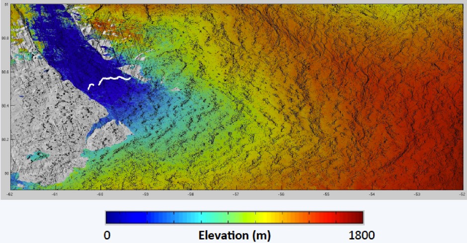
Figure 1: Spatial coverage of standard Level-2 CryoSat-2 data (small black dots on image), compared with drastically improved spatial coverage of ‘swath mode’ processed CryoSat-2 data (small coloured dots on image, colour coded by ice surface elevation (m). N.B. the data doesn’t appear as individual dots, because the data density is so high)
Figure 1: Spatial coverage of standard Level-2 CryoSat-2 data (small black dots on image), compared with drastically improved spatial coverage of ‘swath mode’ processed CryoSat-2 data (small coloured dots on image, colour coded by ice surface elevation (m). N.B. the data doesn’t appear as individual dots, because the data density is so high).
The next steps are therefore to a) improve our understanding of the spatially variable pattern of ice mass loss from the Greenland and Antarctic Ice Sheets by exploiting high resolution ‘swath mode’ altimetry data, to create an assessment of the global ice sheet SLR contribution; and b) to develop a glaciological case study that derives particular benefit from utilising the high resolution swath mode dataset. For example, sub-glacial lake drainage events are currently poorly understood, because without higher resolution data it is not possible to identify individual drainage events with confidence, or to quantify the volume of water transported at the ice sheet base.
Objectives
The aim of this project is to perform a detailed analysis of high resolution ‘swath mode’ altimetry data acquired by the CryoSat-2 satellite between 2010 and the present day, to assess ice sheet elevation, and the rate of elevation change. Specifically, you will:
- Generate an understanding of the swath mode processing technique and dataset.
- Produce a high spatial resolution dataset of the elevation, and elevation change of the Antarctic Ice Sheet, to provide an improved estimate of its present day contribution to sea level rise.
- Make a significant contribution to the ESA STSE CryoTop Follow On project by identifying and then investigating investigating a subglacial lake drainage event in Antarctica using the high resolution ‘swath mode’ dataset.
Training and support
The student will work under the supervision of ESA Independent Research Fellow Dr Anna Hogg and CPOM Director Professor Andy Shepherd.
A studentship within CPOM provides a fantastic opportunity to actively collaborate with a large team of land and sea ice observation and modelling experts at universities across the UK. The project provides a high level of training in: (i) satellite remote sensing; (ii) polar fieldwork; (iii) glaciology; (iii) data analysis and visualization; (iv) calibration and validation of satellite systems; and (v) scientific writing – we strongly support students to write publications during their PhD.
This project offers a particularly attractive studentship because the applicant will have the opportunity to work closely with the European Space Agency, and a number of experienced international collaborators. The successful applicant will also have access to a broad spectrum of training workshops put on by the Faculty that include an extensive range of training workshops in numerical modelling, through to managing your degree, to preparing for your viva. A full list of training opportunities is available.
Requirements
A good first degree (first or high 2.1) or Masters degree in physics, maths, Earth science, climate science, Earth observation or a related discipline. Expertise in computer programming, while not required, will be a valuable asset.
References
Rignot, E., Rivera, A., and Casassa, G., 2003, Contribution of the Patagonia Icefields of South America to sea level rise: Science, v. 302, p. 434-437.
Grey, L., D. Burgess, L. Copland, R. Cullen, N. Galin, R. Hawley, V. Helm (2013) Interferometric swath processing of CryoSat-2 data for glacial ice topography, The CryoSphere, 7, 3133-3162, doi: 10.5194/tcd-7-3133-2013.