
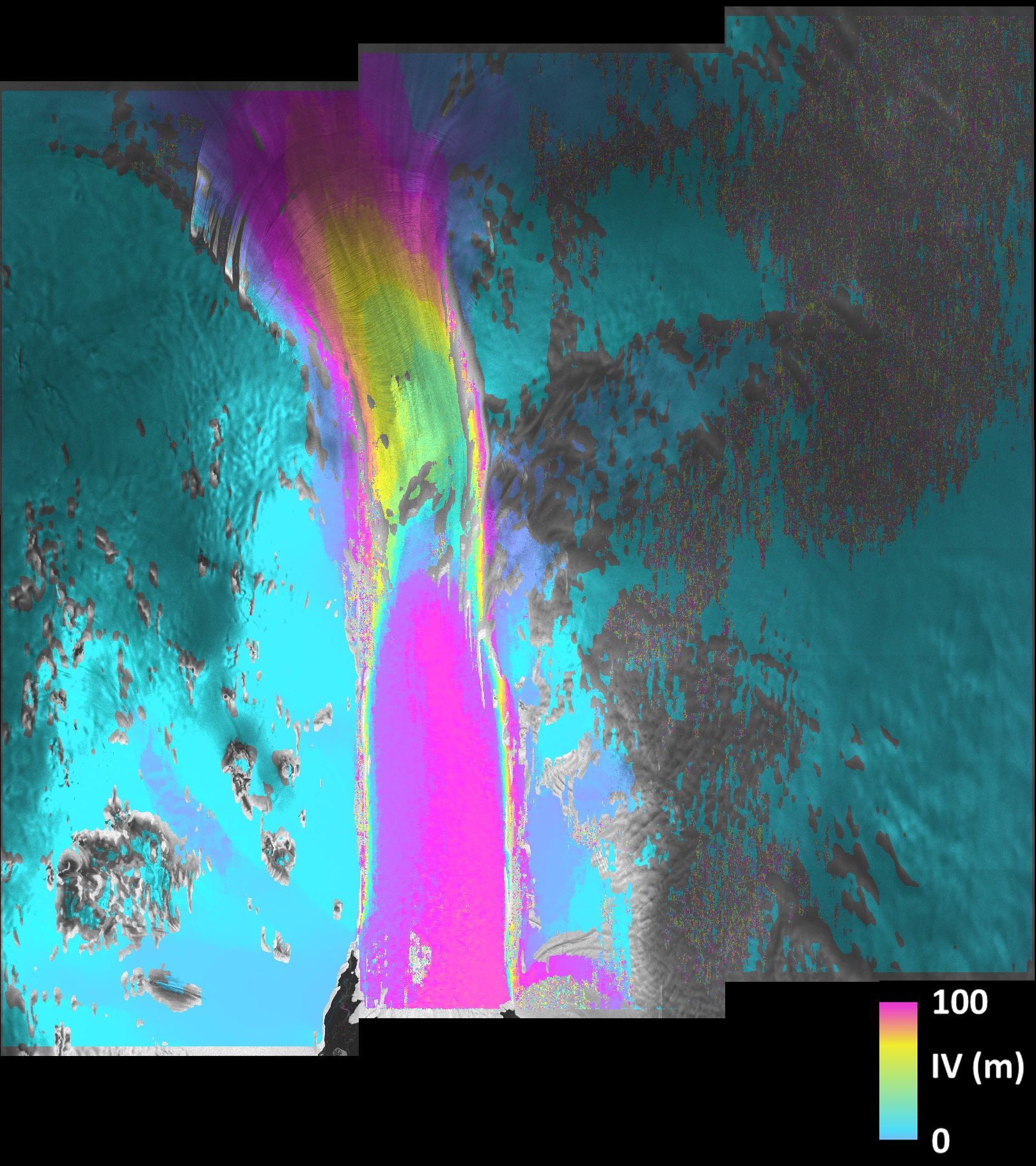
This image combining two scans by Sentinel-1A’s radar shows that parts of the Pine Island glacier flowed about 100 m (in pink) between 3 March and 15 March 2015. Light blue represents stable ice on either side of the stream.
Pine Island Glacier on Sentinel-1A’s radar. Credit: Copernicus data (2015)/ESA/A.Hogg/CPOM
Pine Island is the largest glacier in the West Antarctic Ice Sheet and one of the fastest ice streams on the continent, with an average of over 4 km per year. About a tenth of the ice sheet drains out to the sea by way of this glacier.
With its all-weather, day and night radar vision, the Sentinel-1 mission is an important tool for monitoring polar regions and the effects that climate change has on ice. You can see more images from Sentinel-1A on ESA’s website.