
Earth Observation techniques give us unprecedented access to the polar regions, providing continuous information about sea ice and ice sheets. We use several different Earth Observation tools and techniques to study the cryosphere.
InSAR
Synthetic Aperture Radar Interferometry (InSAR) relies on radar satellites that return to the same area every few days, sending radar waves down to the ground surface and measuring the energy reflected back.
InSAR uses two or more radar images acquired over the same area to detect surface changes. Small changes on the ground cause changes in the radar signal phase and lead to the rainbow-coloured fringes seen on interferograms, which we use to study, for example, land ice velocity. This interferogram shows a Sentinel-1 image of the Dotson ice shelf grounding line.
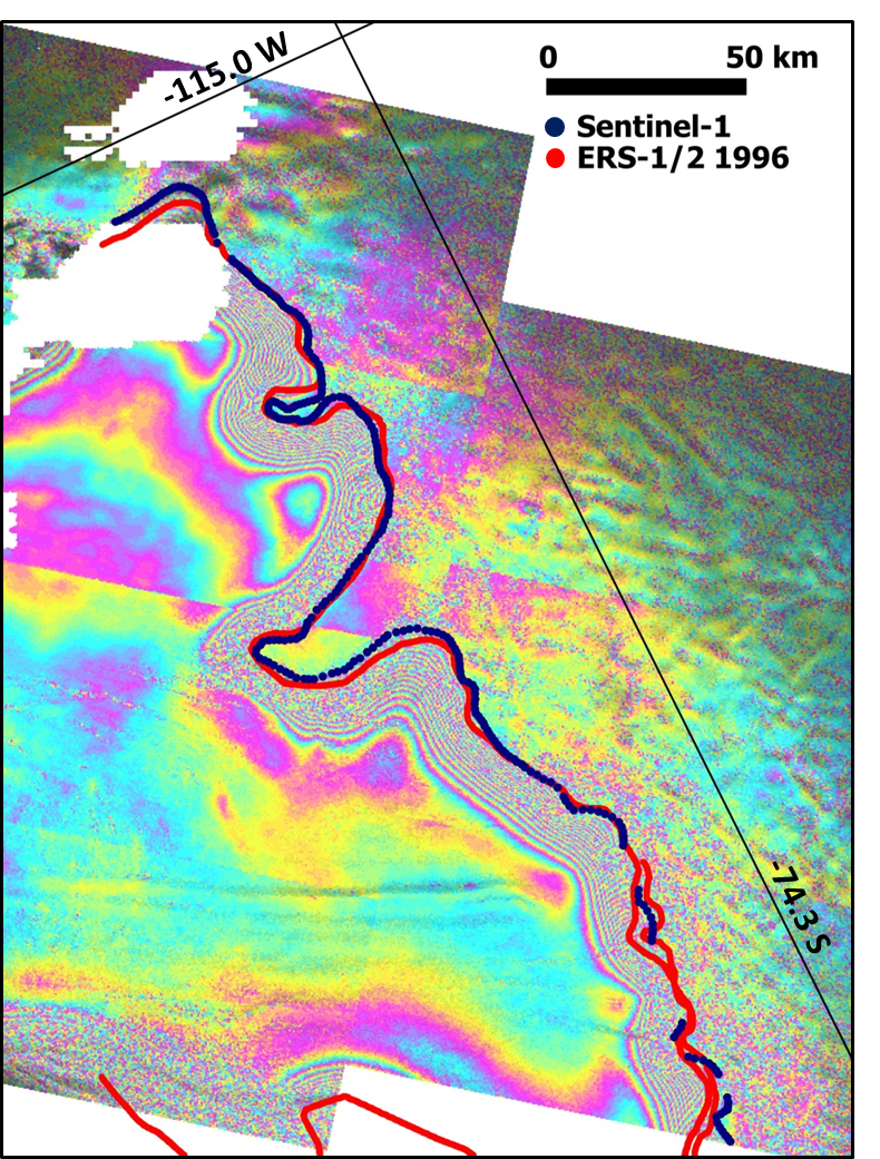
Dotson ice shelf grounding line from Sentinel-1
Altimetry
Radar altimeters are active sensors that measure surface topography along the satellite’s track, which we use to study land ice and sea ice. They provide precise measurements of a satellite’s height above the ocean by measuring the time interval between the transmission and reception of very short electromagnetic pulses. They can measure sea-surface height, the extent of sea ice, and the altitude of large icebergs above sea level, as well as the topography of the ice sheets. Examples include Envisat and CryoSat – the first altimetry mission specifically designed to accurately measure the thickness of sea ice and land ice margins.
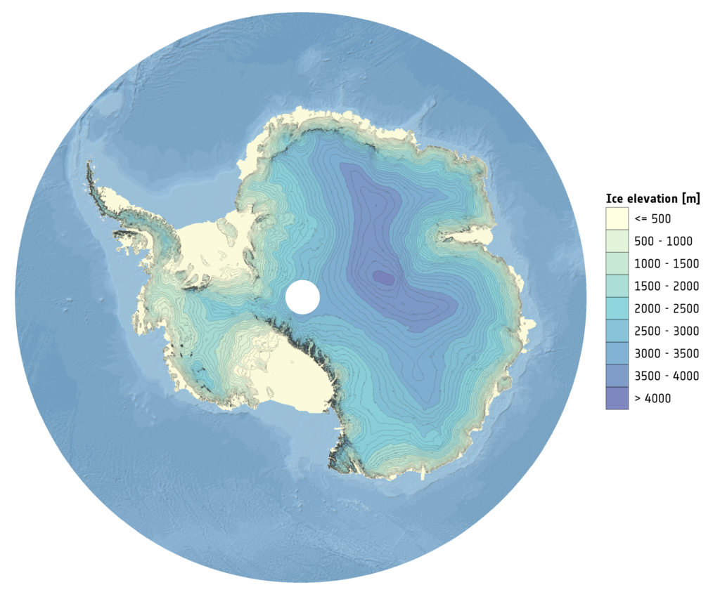
A digital elevation model of Antarctica derived from 6 years of CryoSat-2 altimetry
Gravimetry
Satellite gravimetry has meanwhile improved our understanding of the Earth’s gravity field, which is particularly important in understanding the global oceans. ESA’s GOCE (Gravity field and steady-state Ocean Circulation Explorer) mission has mapped the gravity field with extreme detail, resulting in a unique model of the geoid – crucial for deriving accurate measurements of ocean circulation and sea-level change, and terrestrial ice dynamics, all of which are affected by climate change.

ESA’s GOCE mission