
The following blog was written by Research Fellow, Inès Otosaka based at the University of Leeds.
Last month (December 2022), I went to Antarctica for the first time to conduct some ground experiments over Adelaide Island, located on the western side of the Antarctic Peninsula, as part of the joint ESA CryoVEx/DEFIANT Antarctica campaign.
This campaign aimed to collect a wide range of datasets to investigate drivers of recent Antarctic sea ice changes in the Weddell Sea but also to help interpret differences between land ice height and sea ice thickness retrievals from ESA’s CryoSat-2 radar altimeter and NASA’s ICESat-2 laser altimeter. As part of the CRYO2ICE campaign, CryoSat-2 orbit was recently raised so that CryoSat-2 and ICESat-2 ground tracks coincide in space and time periodically over Antarctica. This campaign was thus a unique opportunity to collect ground and airborne measurements to complement these coincident satellite datasets and better understand the differences between radar and laser data.
This involved sending scientists from the University of Leeds (Andrew Shepherd and myself), from ESA (Isobel Lawrence also a former CPOM colleague), from BAS (Gaëlle Veyssière and Carl Robinson), and from DTU (Sebastian Simonsen) to Antarctica for two weeks to collect these datasets. However, many more colleagues were involved in the preparations ahead of the campaign – from the testing of the various instruments to the coordination of the campaign logistics – and contributed greatly to the success of this campaign.
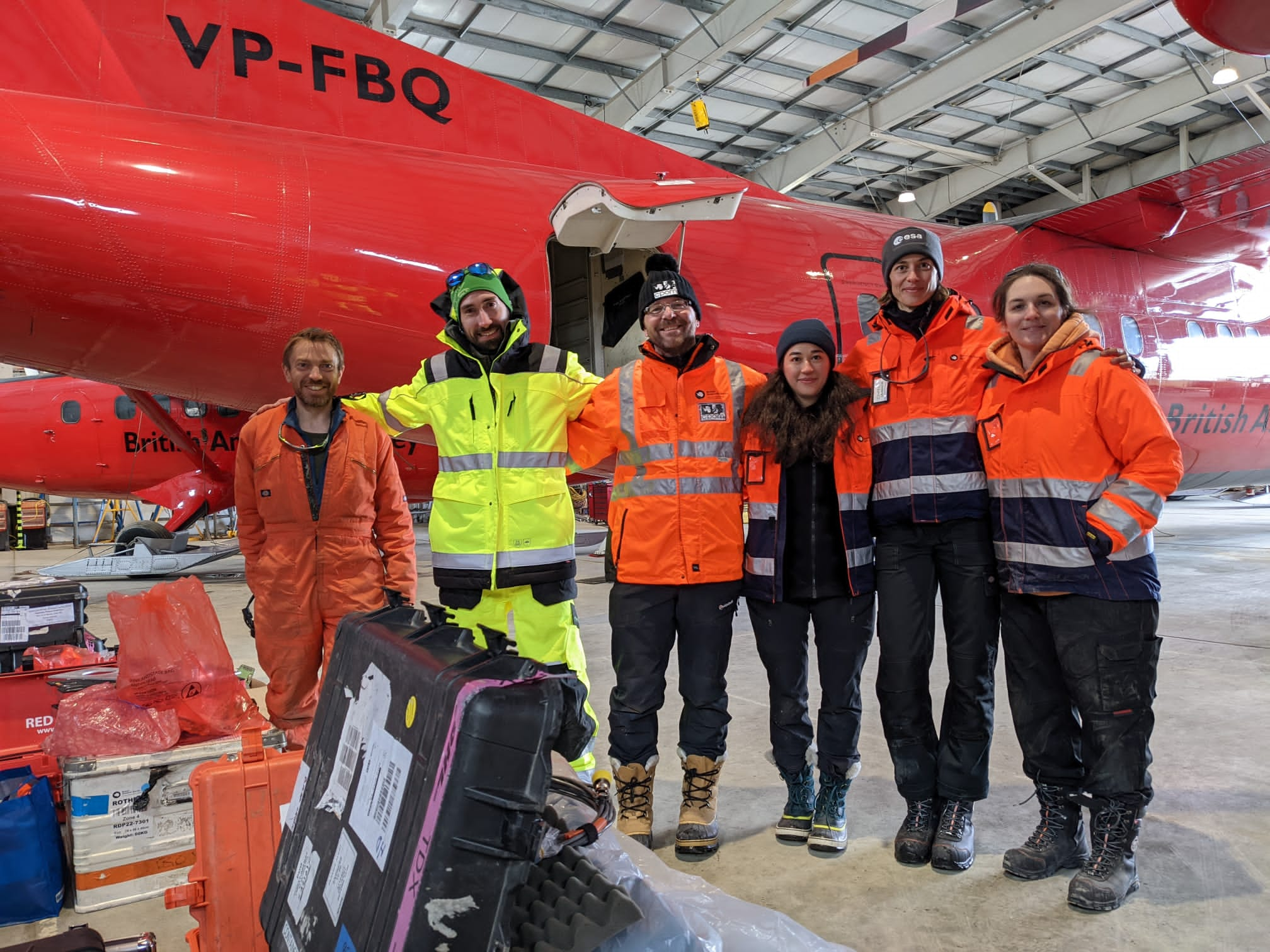 |
| CryoVEx/DEFIANT team in the hangar at Rothera (from left to right: Carl Robinson, Sebastian Simonsen, Andrew Shepherd, Inès Otosaka, Isobel Lawrence, and Gaëlle Veyssière) |
Andy and I departed from Leeds on 29th November and after travelling more than 13,000 km, we arrived in Punta Arenas at the tip of Chile where we met with the rest of the scientific team. We stayed for four days in Punta Arenas waiting for the weather to clear up for our flight to Antarctica and on 5th December, we finally boarded our plane to Rothera, the British Research Station where we would be based for the next two weeks.
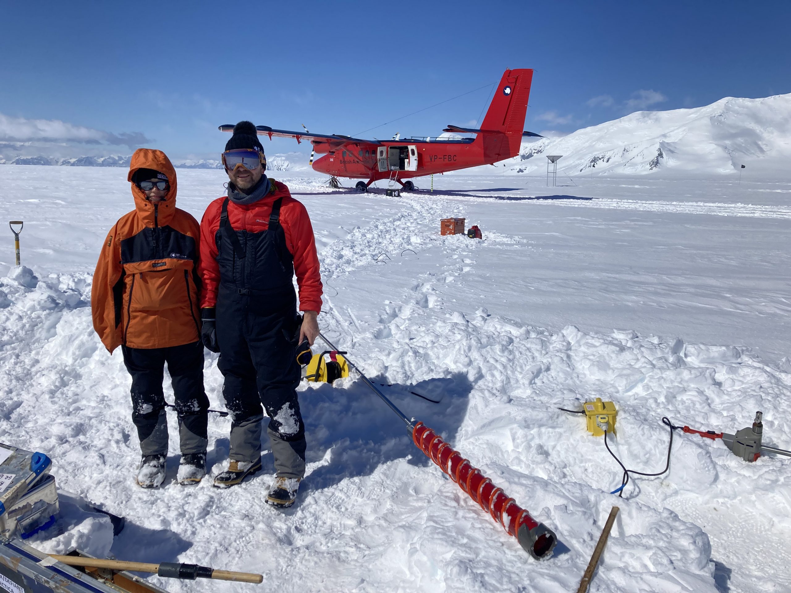
We were greeted with spectacular views of the station on our arrival with lots of icebergs and after a tour of the station, we reviewed our plans for the next few days. While Andy and I were in charge of collecting the ground measurements, Isobel, Gaëlle, Carl, and Sebastian were in charge of collecting the airborne measurements. We spent the first day preparing our kit before going to the field while the airborne team started setting up the DASH-7 for the airborne surveys. The DASH-7 is usually used as a passenger aircraft to transport people between Rothera and Punta Arenas (it had been 25 years since it was last used as a scientific survey plane), which meant that all the seats had to be removed so that racks of instruments could be installed inside the plane instead. The airborne team then flew to the Weddell Sea, trying to follow the CRYO2ICE satellite tracks as closely as possible in time and space, which involved some long hours flying on the DASH-7 monitoring the various instruments to make sure that all the data were being acquired properly.
In the meantime, on the ground, we installed four corner reflectors to be surveyed by the airborne team, which will be used for calibrating the different datasets together after the campaign. These very large metal reflectors are digged 1-meter deep into the snow and set up to be around 2 meters above the ground so they can provide a common reference surface for the radar and laser data.
 |
| Installing a corner reflector on Fuchs Ice piedmont, Adelaide Island. |
We also collected some shallow firn cores around the island to measure the density and stratigraphy of the firn. We are especially interested in the depth of ice lenses that form within the firn as those are the signatures of past melt events and we have seen in Greenland that they change the scattering properties of the firn, which can impact surface heights measurements from CryoSat-2.
 |
| Drilling 7-meter deep to collect a firn core on Fuchs Ice piedmont, Adelaide Island. |
We had great weather conditions during those two weeks, and managed to collect all the measurements we had hoped for thanks to the support of the incredible team working at Rothera research station, including the field guides and pilots that came with us in the field, staff at the hangar, and Maz the science coordinator – among many others!
Finally, while we were busy for most days we still managed to find some time to walk around the station and were lucky enough to spot some penguins, seals, and even a pod of orcas! This campaign was a great success and it was incredibly rewarding to see all the work that had been done over the months preceding the actual fieldwork come to fruition. Next, we will be analysing all the data collected, which is another exciting step – although it will have to be done from our office desks far from the beautiful scenery of Antarctica!
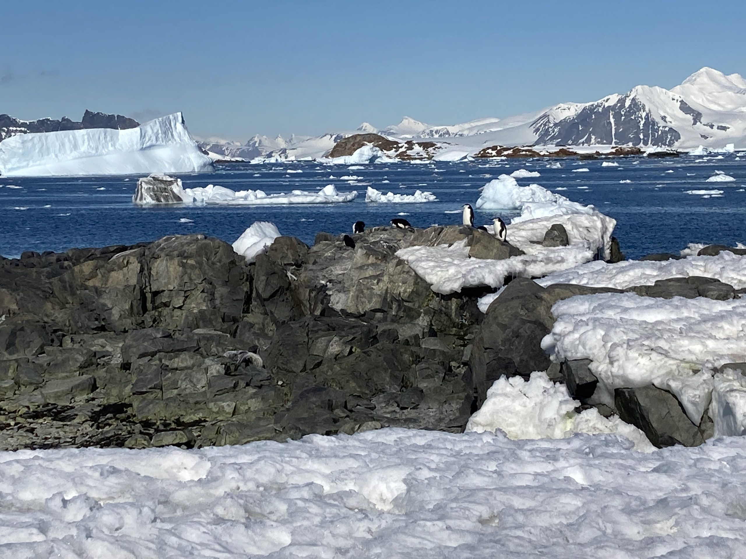 |
| Penguins around Rothera Point |