
CPOM uses satellite observations alongside models of ice sheet-ocean coupling, sea ice evolution and ocean dynamics to assess changes in the Arctic climate system. This includes sea ice volume and transport, ocean dynamic topography, and Greenland ice sheet mass balance.
Models of sea ice area currently give a wide range of volume estimates. To address this, we are combining data from different sources to produce a continuous record of Arctic-wide sea ice thickness since 1992. This will allow us to explore trends in thickness and volume and, combined with estimates of ice drift, mass flux out of the Arctic Ocean via the Fram Strait – the passage between Greenland and Svalbard.
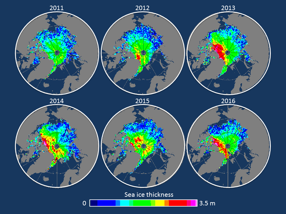
Maps of November Arctic sea ice thickness recorded by CryoSat-2. Although ice is thicker than usual north of Canada, there is less ice overall in southerly regions such as the Beaufort, East Siberian and Kara Seas.
Similarly, the relationship between the Arctic Ocean and the Greenland ice sheet is not well understood. Ice losses from Greenland are among the largest sources of fresh water to the ocean, but changes to the temperature of the Arctic Ocean can also affect the ice sheet.
CPOM is producing estimates of Greenland ice sheet mass balance, as well as ice sheet runoff from regional climate models. Together, these will provide an assessment of Greenland’s freshwater contribution to the Arctic Ocean and help studies of coastal-ocean circulation. We will also continue to model the impact of the Arctic Ocean on the ice sheet.
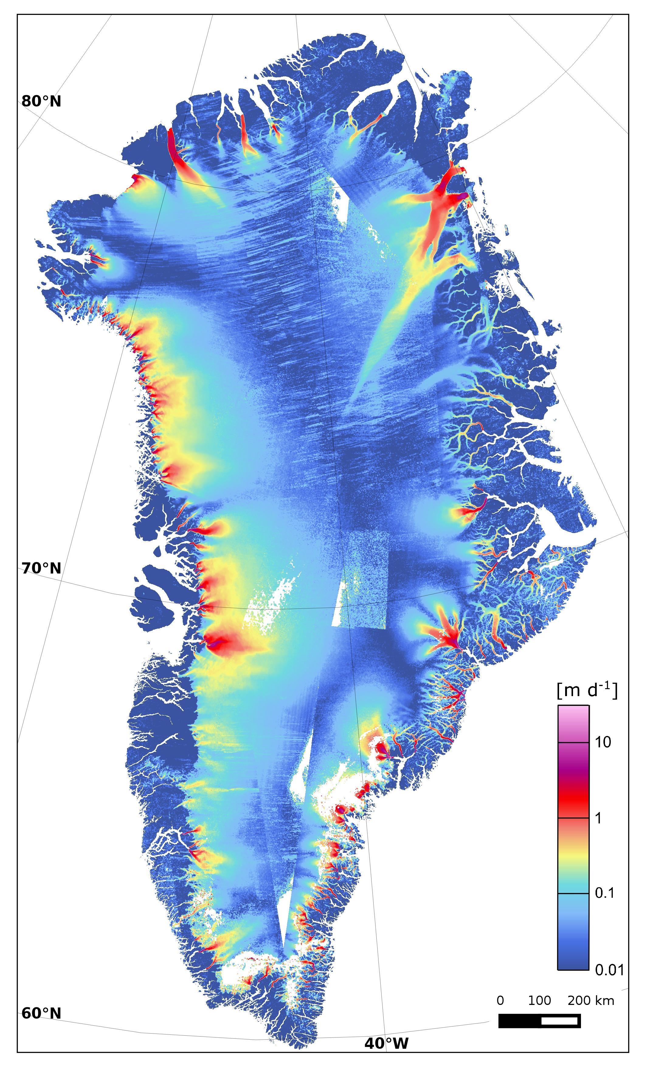
Greenland ice sheet velocity from Sentinel-1 data Jan-Mar 2015 Credit:Copernicus Sentinel data (2015)/ENVEO/ESA CCI/FFG