
By Dr Tom Armitage (CPOM Research Associate, UCL)
Whilst a large part of what CPOM does relates to polar ice – sea ice and land ice – oceans play a very important role in the Polar Regions. The Arctic itself is of course an ocean, despite being covered by millions of square kilometres of sea ice for much of the year, and the vast Southern Ocean surrounds the Antarctic continent.
These components of the global ocean play an important role in driving the global ocean overturning circulation and interactions between the oceans and the Greenland and Antarctic Ice Sheets are helping to drive some of the ice losses from these continents. Much of my PhD research at CPOM-UCL focussed on using the record of satellite altimetry to measure sea level and ocean circulation in both the ice-free and ice-covered portions of the Arctic Ocean.
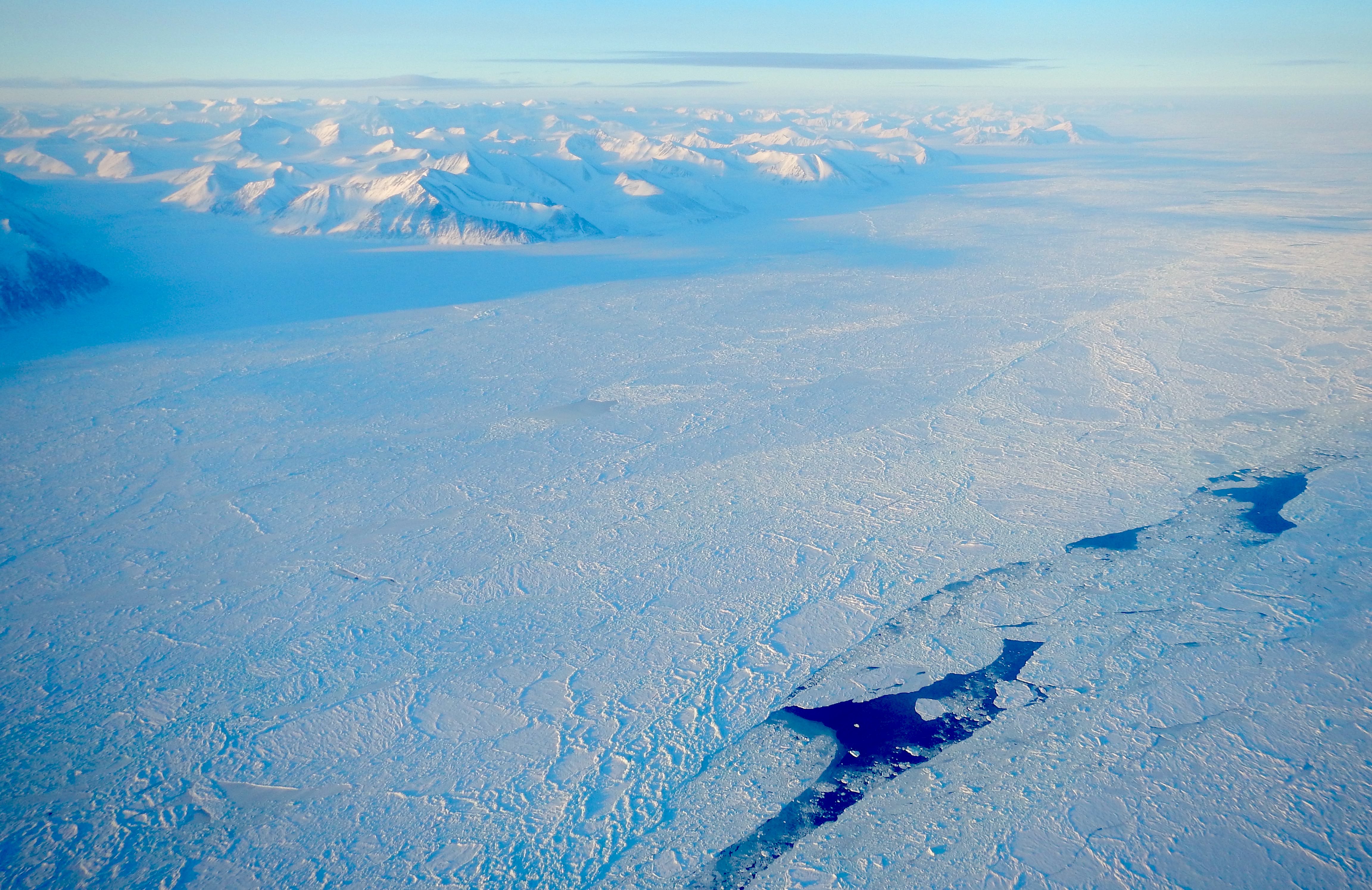
A lead (crack) in the sea ice in the Lincoln Sea, north of Greenland, March 2014 (lower right). Leads can be used to estimate sea level in the ice-covered portions of the Arctic Ocean.
The Arctic Ocean represents just 4.3% of the global ocean area, making it the smallest of the world’s major ocean divisions. It is largely enclosed by land, limiting it’s interactions with the rest of the global ocean, and sea ice acts as a barrier between the ocean and the atmosphere, limiting exchanges of heat and mechanical energy between the atmosphere and ocean. The surface layer of the Arctic Ocean (the upper few hundred meters) stores somewhere in the region of 80,000-90,000 cubic kilometers of cool and buoyant freshwater, which overlies warmer water at depth (for comparison, the Greenland ice sheet is currently shedding around 300 cubic kilometres of freshwater per year). The resulting stratification isolates the deep ocean from the action of the atmosphere. These factors combined mean that the Arctic Ocean is relatively quiescent, with slow current speeds and low levels of vertical mixing.
Despite this, the Arctic Ocean is an important and unique component of the global ocean. Excess freshwater outflow from the Arctic has the potential to slow the overturning circulation in the Nordic and Labroador Seas by acting as a fresh ‘cap’ that inhibits the formation of dense deep waters. This could cause cooler atmospheric temperatures in western Europe as less northward flowing oceanic heat would be released to the atmosphere in the North Atlantic (actually, western Europe would still warm due to man-made climate change, but some of this rise would be offset, resulting in lower rates of warming). The so-called ‘great salinity anomaly’ of the 1970s – at the time labelled “an extreme variation in ocean climate” – was caused by an excess outflow of just over 2% of the freshwater stored in the Arctic Ocean surface layer.
Thus, a picture emerges of the Arctic Ocean and its role in the global climate: it is an isolated, stratified and sluggish ocean, but one which is in a delicate balance with the global ocean and could have a significant impact on northern hemisphere climate if that balance is disrupted. Important questions then arise: what is happening to the ocean as the sea ice layer recedes, thins and weakens under a changing climate, exposing the ocean to the atmosphere and wind? Is the Arctic Ocean becoming more like a conventional ocean without its protective sea ice layer? If the Arctic Ocean is being ‘stirred up’, is it possible that the warmer deep water could be mixed to the surface, where it can directly melt more sea ice?
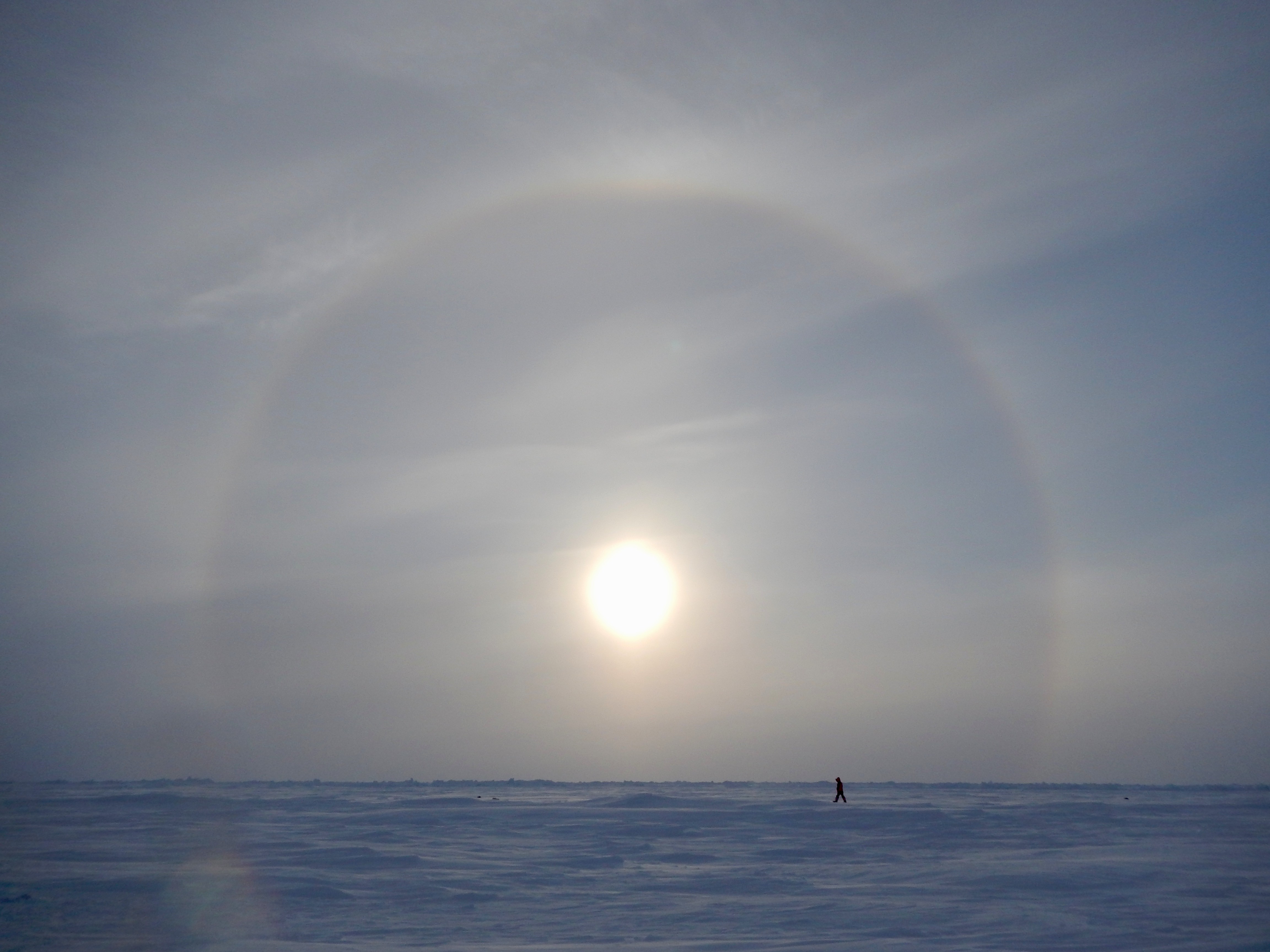
Fieldwork in the frozen Arctic Ocean. Underneath the few meters of sea ice is an ocean thousands of meters deep.
To address these questions, during my PhD at CPOM-UCL I produced a 12-year record of Arctic Ocean sea level and surface circulation using data from the ESA Envisat and CryoSat-2 radar altimeters. I examined the role of freshwater exchanges at different timescales, changes in upper ocean circulation and considered links to changes atmosphere-ocean interactions due to sea ice loss.
What makes the Arctic Ocean breathe?
The observations reveal a large (±4cm) seasonal cycle of Arctic sea level that is dominated by variations in steric sea level.
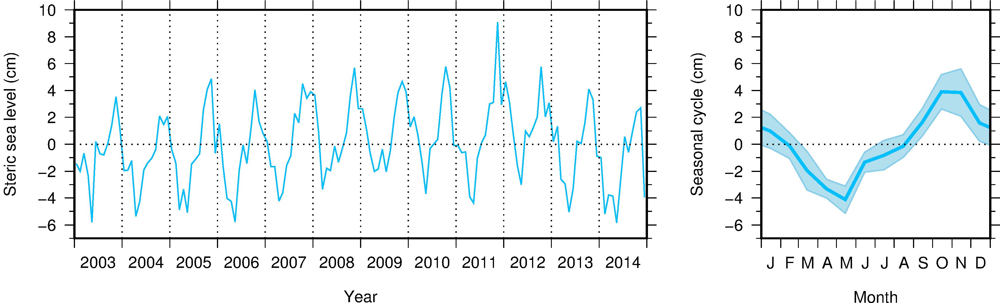
The steric sea level in the central Arctic Ocean between 2003 and 2014 (left) and the average seasonal cycle during this period (right)
Changes in steric sea level are caused by variations in ocean density, which in the Arctic is dominated by variations in the amount of freshwater in upper layers of the ocean, or alternatively, how diluted the salty ocean water is relative to the average ocean ‘saltiness’. In this way, the seasonal cycle of sea level is driven by the seasonal input of freshwater into the Arctic Ocean.
In early summer the terrestrial Arctic thaws and a vast amount of meltwater flows into the large Siberian rivers where it eventually flows into the Arctic Ocean. Overall, whilst the Arctic Ocean represents just 1.4% of the global ocean volume, it receives around 11% of global river runoff. At the same time, during summer, high precipitation and melting sea ice also freshen the upper Arctic Ocean. The steric sea level duly rises during the summer as the seawater becomes fresher and less dense, peaks in October and November and falls during winter as sea ice is formed, making the seawater denser again, and is exported from the Arctic to the Nordic Seas.
Regional freshwater exchanges
During the period of this study, there was a bulging of the steric sea level in the Beaufort Gyre, north of Canada and Alaska, which corresponds to an accumulation of surface freshwater.

Freshwater content change (left) for the western Arctic region shown on the map (right)
Relative to the beginning of the study period, the Beaufort Sea region contained almost 5,000km3 more freshwater in 2010 (see Awakening the Arctic Ocean below). A small proportion of this freshwater (around 200km3) was drawn off the Siberian shelf seas into the Beaufort Gyre and, at the same time, loss of sea ice in the Arctic contributed a further few hundred cubic kilometres of additional freshwater. These increases in freshwater input to the Beaufort gyre cannot account for the total increase in freshwater content in this period, so there must have been a reduction in freshwater outflow. A wind-driven reduction in outflow of around 15% over a few years could account for the accumulation seen in the Beaufort gyre during the late 2000s.
It remains an open question as to what will happen if the wind forcing supporting the increased freshwater in the Beaufort gyre weakens. The data shows drops in the freshwater content of the Beaufort gyre towards the end of the study period and other studies have linked the storage and release of freshwater in the Beaufort gyre with salinity anomalies in the North Atlantic. So, it is possible that the reduction in Beaufort gyre freshwater seen in the data between 2012 and 2014 could show up in the North Atlantic over the next few years. It remains to be seen if other data corroborates with our observations.
Awakening the Arctic Ocean
There were also significant changes in the Arctic upper ocean currents. In the period of maximum Beaufort Gyre freshwater content – roughly 2007-2012 – current speeds around the Beaufort Gyre were elevated.
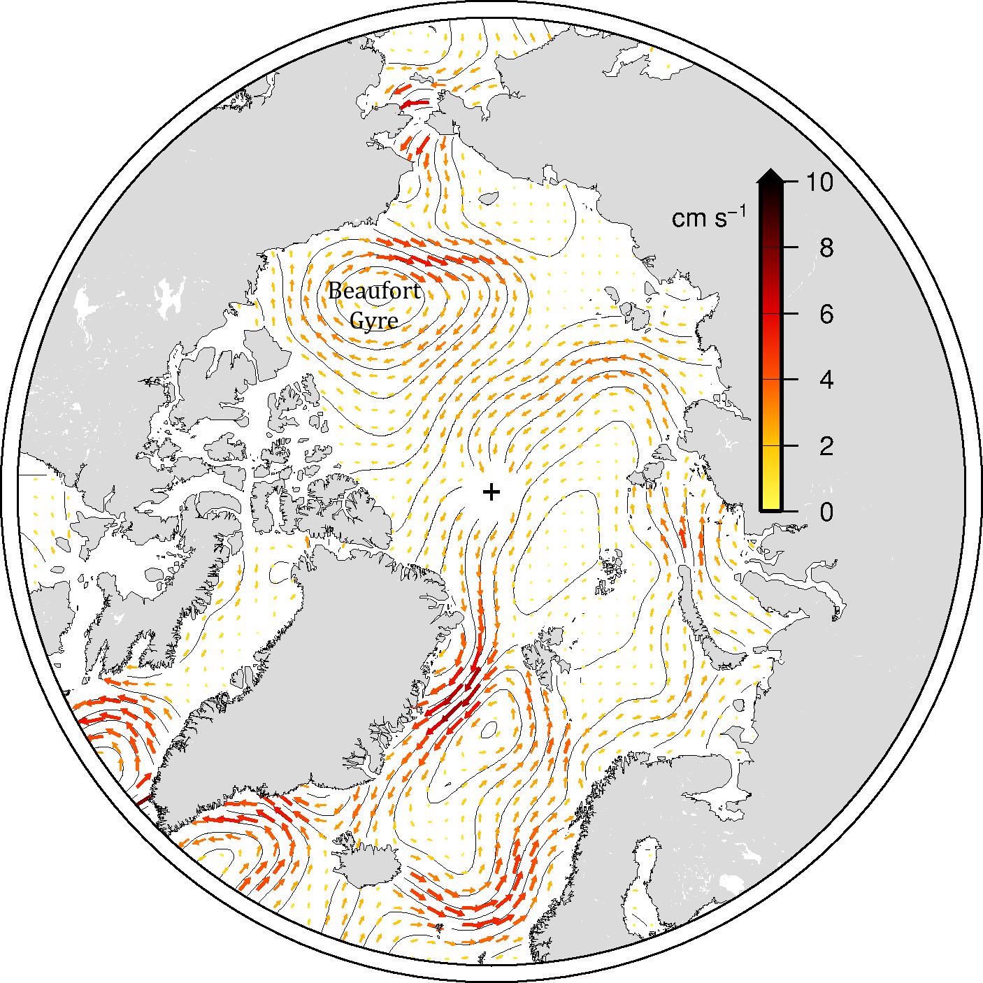
The mean Arctic Ocean upper ocean currents (arrows) and contours of sea level (drawn every 5cm) as measured by CryoSat-2. Surface currents generally follow contours of sea level, much as wind follow contours of atmospheric pressure. The location of the Beaufort Gyre, a peak in sea level, is shown
Taken together, the observational evidence suggests that, particularly in the late-‘00s, the wind became more efficient at transferring mechanical energy to the ocean, leading to freshwater accumulation and increased ocean currents. There are likely several contributing factors at play: the reduction of sea ice coverage, thinning and weakening of the ice pack, the almost complete loss of the oldest (5+ years) deformed sea ice and atmospheric circulation patterns. Further observations and modelling studies are required to say for certain which factors are most important in driving these changes. But the observations make it clear that sea ice loss associated with climate change is having an effect on the underlying Arctic Ocean, and that monitoring the Arctic Ocean should be a priority due to the potential impact on climate at lower latitudes. What would happen, for example, if the freshwater accumulated in the Beaufort Gyre were released to the North Atlantic? Do increased currents mean that there will be more ‘stirring’, and mixing of deep warmer waters upwards to the surface?
Arctic monitoring
We will continue to develop and extend our sea level data to establish a long-term record of ocean change in the Arctic. Sea level is considered an important indicator of climate change but consistent long-term records of sea level in the Arctic have so far been lacking, despite the fact that the Arctic is seeing some of the most rapid climate changes on Earth. Humans are currently performing one of the largest ever (if unintended) oceanographic experiments by removing the sea ice layer of the Arctic Ocean. Using sea level data from polar orbiting radar altimeters, and by making it available to other researchers, we can contribute to determining how the Arctic Ocean is responding.
Further reading
Armitage, T. W. K., S. Bacon, A. L. Ridout, S. F. Thomas, Y. Aksenov and D. J. Wingham (2016), Arctic sea surface height variability and change from satellite radar altimetry and GRACE, 2003-2014, J. Geophys. Res. Oceans, 121, doi: 10.1002/2015JC011579