
By Tom Armitage, CPOM Research Associate at UCL
The Centre for Polar Observation and Modelling (CPOM) is a Natural Environment Research Council Centre of Excellence. The CPOM directorate is based at the University of Leeds, and there are researchers and affiliates based at University College London, the University of Reading and the University of Bristol. We also work closely with colleagues at the British Antarctic Survey, National Oceanography Centre, National Centre for Earth Observation and the European Space Agency.
I personally became involved with CPOM in the final year of my undergraduate masters degree in physics at UCL. I had taken several courses on the physics of atmospheres, Earth and the climate, and, disillusioned by the choice of final year projects that were being offered by the physics department, decided to contact Prof. Duncan Wingham, who was the head of CPOM at UCL at that time. I enjoyed my project with Duncan, analysing CryoSat-2 data over the Greenland ice sheet, and went on to take a one-year Young Graduate Trainee position with ESA, this time analysing CryoSat-2 data over sea ice. A PhD was the natural progression, so I returned to UCL in 2012 and I recently completed my PhD studying the Arctic Ocean using satellite data (more to follow in later posts). My route into CPOM isn’t atypical – many researchers involved with CPOM have undergraduate degrees in physics for example, and enjoyed the Earth physics modules more than the traditional physics modules so ended up stumbling across CPOM.
Broadly, as a research group, we study the Earth’s cryosphere – the regions of the Earth’s surface, land and ocean, that are continuously or seasonally covered by ice – and the role that the cryosphere plays in Earth’s climate system. To do this this we use a suite of different techniques that can be broadly divided into the two categories encompassed by our name: observation and modelling.
Observation: Chiefly, we make use of satellite data that allows us to make year-round, all-weather observations of Earth’s polar regions. Satellite data has revolutionised our understanding of these remote but important regions of the Earth over almost four decades. Using satellites, we have been able to measure the rate that the Greenland and Antarctic ice sheets are melting and contributing to global sea level rise; measure the speed at which glaciers and floating ice shelves are flowing into the ocean; measure the drainage of sub-glacial lakes that lie beneath thousands of meters of ice; measure year-to-year variations in Arctic sea ice growth and melt; measure the speed of sea ice as it is blown across the surface of the ocean by the wind; and estimate sea level change and ocean currents in the ice-covered Arctic Ocean.
This animation shows changes in ice volume in Antarctica, Greenland and the Arctic ocean measured by the CryoSat satellite, 2010–2015:
Of course, other sources of data are vital to help interpret observations from satellites; we take part in field activities to collect data, both by aircraft and on the ground, which can be used to evaluate results from satellites. For example, in March 2014 my colleague Rachel Tilling and myself, along with Ewan Shilland from UCL Geography, took part in a CryoSat validation campaign, during which we camped and collected data on the sea ice north of Greenland, in the Lincoln Sea. This was a hugely collaborative, international effort, involving both ESA and NASA’s Operation IceBridge; it was extremely exciting and we collected invaluable data to assess the performance of CryoSat-2 over sea ice. We also blogged about our experiences.
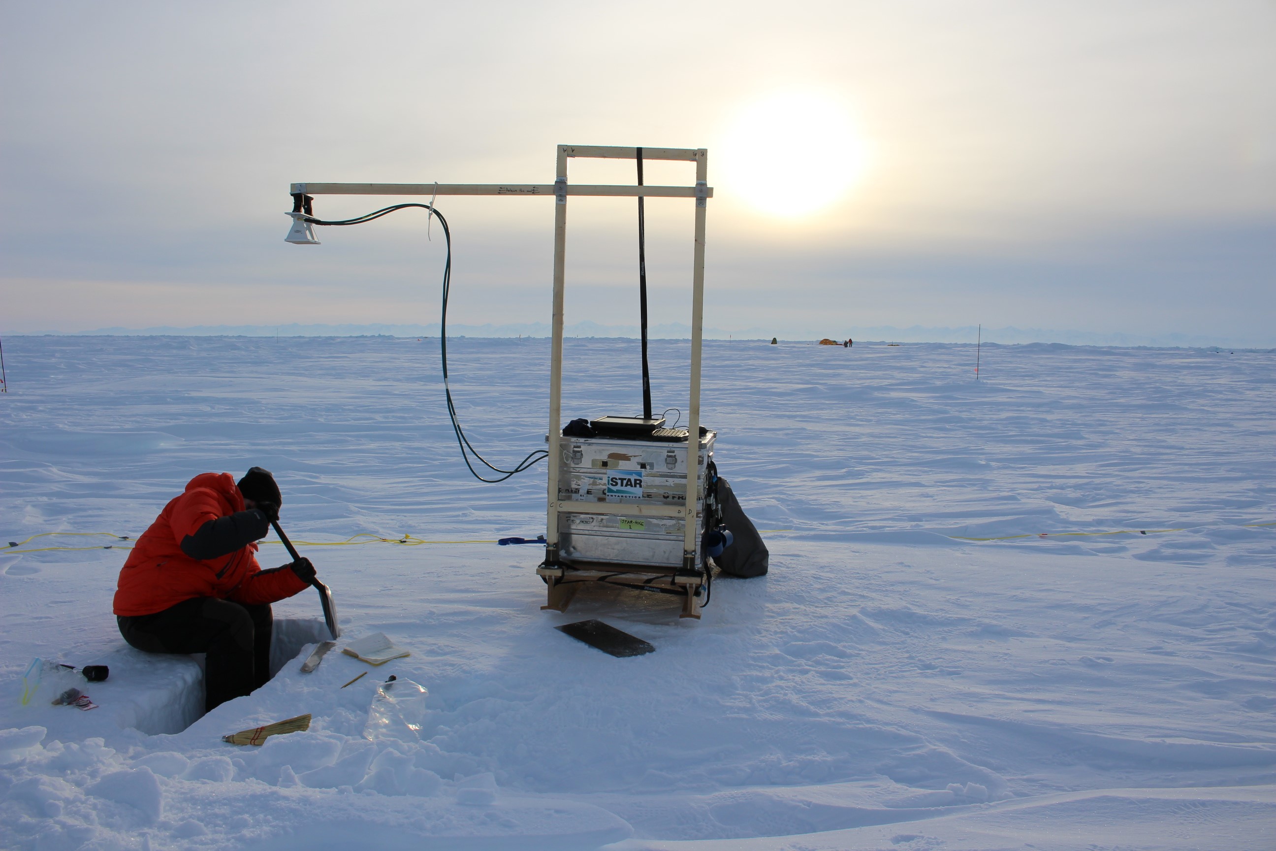
Credit: Rachel Tilling
Modelling: Modelling activities are split between sea ice and land ice. The sea ice modelling group at the University of Reading focuses on using small-scale, idealised representations of processes and interactions that occur in the atmosphere-sea ice-ocean system to better understand the physics of sea ice. An example is a recent study that demonstrated the important role that melt ponds play in regulating the summer melt of sea ice and that melt pond coverage can be used to effectively predict the amount melt will occur. These insights can be incorporated into large-scale sea ice models to drive improvements in the way sea ice is represented in climate models, and ultimately to drive improvements in predications of sea ice under a changing climate. Land ice modelling activities focus on improving our understanding of the evolution of the Greenland and Antarctic ice sheets. Currently, projections of sea level rise into the 21st century are limited by uncertainties surrounding the stability of the ice sheets under climate change, in particular the West Antarctic Ice sheet. By improving our understanding of important ice sheet processes it is hoped that we can better constrain estimates of future sea level rise.
By producing high quality studies, CPOM has always had a presence in the public eye through various media. We hope that this blog can add to that mix. In this blog we aim to do several things:
- Provide an overview of CPOM projects and current activities.
- Discuss important results and papers coming out of CPOM activities.
- Provide timely analysis and commentary on emerging results in polar research.
Polar science is a rapidly evolving and exciting area of research, and one that captures a lot of public attention. Through our broad expertise in polar sciences we hope this blog will be both interesting and insightful, and provide a useful source of information and discussion about the cutting edge of polar science.