
iSTAR D, led by Andy Shepherd, is using ice-based measurements of the Amundsen sector ice streams to reconstruct data missing from historic satellite records, reduce uncertainties in projections for the future, and provide a more comprehensive picture of mass ice loss.

Credit: BAS
Measurements from successive Earth-orbiting satellites, including CryoSat, have provided valuable insights into Antarctica’s large ice sheets. While these satellite observations allow us to estimate how much ice is being lost to the ocean, they cannot distinguish changes in ice density from changes in mass; or changes due to mass ice loss from those due to the motion of the underlying solid Earth.
iSTAR-D has captured ice-based measurements through an 800 km traverse over the Pine Island Glacier basin, including extraction of ice cores to obtain a continuous record of snowfall and density; calculation of annual accumulation rates from data collected by high-resolution snow radar; and use of GPS stations attached to nunataks to monitor the motion of the solid Earth.
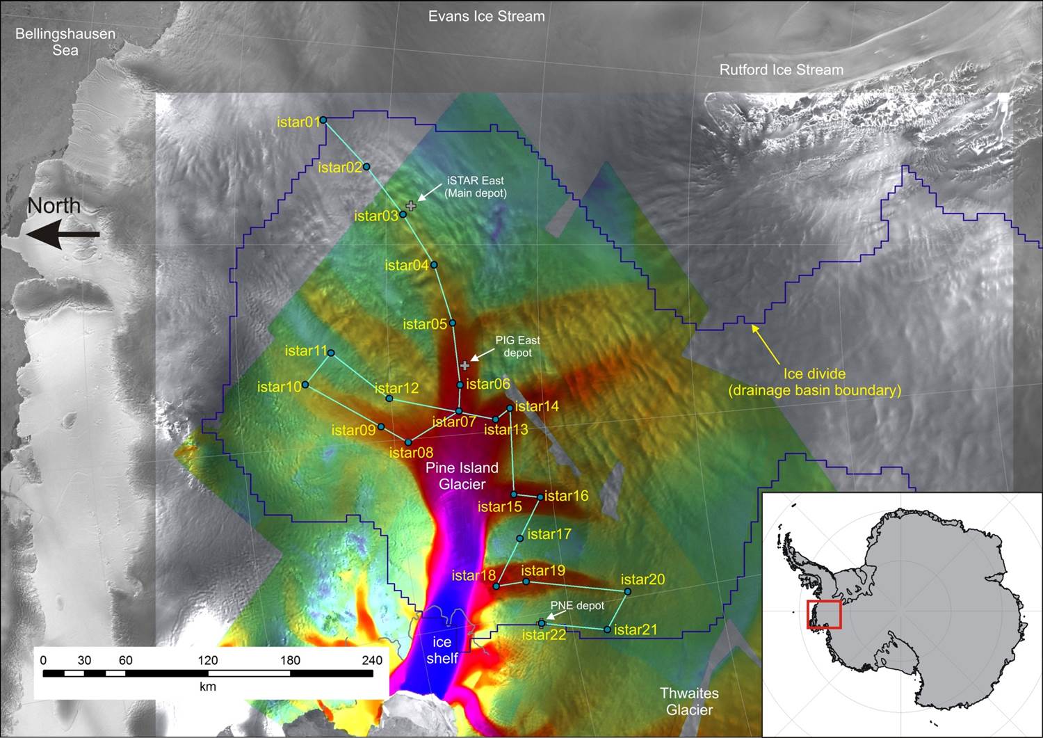
iSTAR-D traverse
The observations are being used to evaluate and update models of Antarctic accumulation, density and solid Earth motion; and to determine the errors in the historical (from 1992) and on-going satellites data. All of this will be used to generate the best estimate of the West Antarctic Ice Sheet’s contribution to sea level throughout the Amundsen sector basins.