New machine learning tool maps Arctic ice faster

New machine learning tool maps Arctic ice faster

New publication in Nature Communications introduces GPSat, a tool that helps process constantly changing satellite data, more quickly and efficiently than older methods. This tool can help scientists better monitor changes in sea ice over time and help improve predictions for sea-level changes.

GPSat can produce detailed maps of Arctic sea ice, filling in any gaps in the satellite data and can produce data more than 500 times faster than older methods while maintaining accuracy (demonstrating less than 4 mm difference on the derived freeboards on average).

The paper, authored by William Gregory (Princeton) and involving CPOM co-authors Isobel Lawrence (ESA), Carmen Nab (UCL) and Michel Tsamados (UCL), was published on 28 August 2024 in Nature Communications.

Author information:
Gregory, W., MacEachern, R., Takao, S. et al. “Scalable interpolation of satellite altimetry data with probabilistic machine learning”. Nat Commun 15, 7453 (2024). https://doi.org/10.1038/s41467-024-51900-x

CPOM’s Dr Sammie Buzzard features in stunning new planetarium show at Life Science Centre

CPOM PI Dr Sammie Buzzard (Northumbria University) is featured in stunning new Earth Defenders! planetarium production now showing at Life Science Centre in Newcastle upon Tyne.

Sammie portrays a scientist in a televised documentary introducing Earth Defenders! which follows the action-packed stories of five superhero characters based on real satellites used for a range of earth-protecting purposes. One of the featured satellites is ESA’s CryoSat-2, which produces data CPOM uses to measure both sea ice and the polar ice sheets.

Earth Defenders! also includes asteroid detector NEOWISE, Biomass which observes forests, MetOp which increases the accuracy of weather predictions and global navigation satellite system, Galileo. These satellites have been brought to life by the talented team at the Life Science Centre to educate and inspire a younger audience on the power of earth observation.

Sammie, an expert on Ice Shelf Earth Observation said: As someone who uses satellites in their research into the Earth’s rapidly changing polar regions, I’m thrilled that Life are showing visitors how important satellites are and are making them accessible to a younger audience. At CPOM we’re especially excited to see our favourite satellite, CryoSat-2, brought to life!

The show, which is projected across the 360-degree domed Planetarium, provides a unique, immersive experience and is a must-see for children and adults alike who live in, or are visiting, the North East this summer.

Rosie’s #CPOMOriginStory

There are many routes into polar science from maths to geography and physics.

Our #CPOMOriginStories series of videos explores the different routes our scientists took to kick start their careers in glaciology and polar science.

In the first of the series we have been talking to CPOM’s PI for Sea Ice Earth Observation, Dr. Rosemary Willatt (Northumbria University) about how she first became interested in observing the cryosphere from space.

If you’re interested in finding more about polar observation and modelling, keep an eye on our website for new opportunities to get involved.

CPOM’s Dr Ines Otosaka gives evidence to the Environmental Audit Sub-Committee on Polar Research

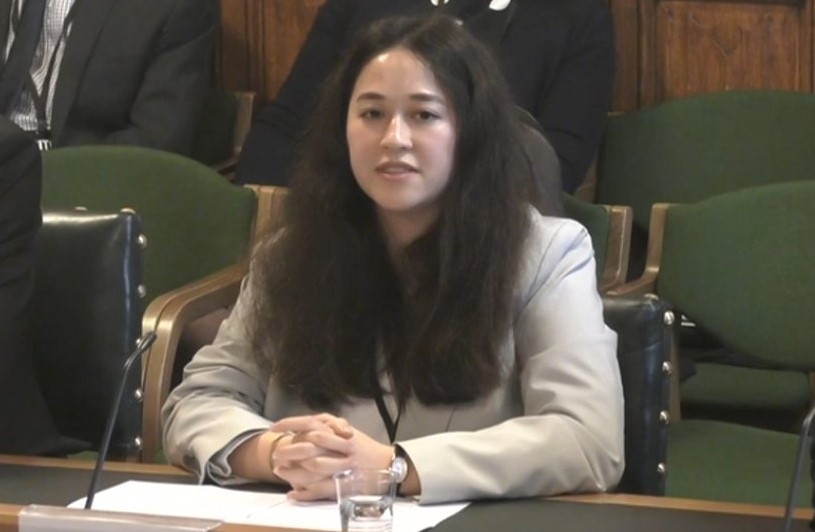
CPOM co-Director Dr Ins Otosaka (Northumbria University) gave evidence yesterday to the Environmental Audit Sub-Committee on Polar Research as part of The UK and Antarctic Environment Enquiry.

The meeting, which took place at the House of Commons, also included evidence from scientists and Directors from the British Antarctic Survey (BAS) and the National Environment Research Council (NERC) as well as Durham University.

The Inquiry is exploring the effects of climate change in Antarctica and how UK science can play a role in understanding this change and protect the region. It also considers what the UK Government can do to meet their obligations under the Antarctic Treaty.

The Centre for Polar Observation and Modelling investigates processes in the earth’s cryosphere, including in Antarctica, using satellite observation data and numerical modelling. Through this CPOM aims to understand how Antarctica, and other aspects of the cryosphere, are changing and the potential impact of these changes on the global climate.

Dr Ins Otosaka is a lecturer at Northumbria University and her research focuses on using satellite and airborne altimetry data of the Antarctic and Greenland icesheets to detect and interpret changes and estimate their contribution to sea level rise.

You can watch the full hearing on Parliament TV.

CPOM’s Professor Andrew Shepherd and Dr Sammie Buzzard feature in POP23 video


CPOM Director Prof Andrew Shepherd and CPOM Assistant Director Sammie Buzzard discuss the importance of protecting our polar regions and how we monitor them here at CPOM in this educational video from the Protecting Our Planet 2023 event run by Stem Learning.

European satellite ERS-2 returns to earth after almost 30 years

(First published: 22 Feb 2024)

This week we watched along with many across the globe, as pioneer European satellite ERS-2 finally made its journey back to earth after almost 30 years monitoring earth from the sky.

For many current and former CPOM scientists, this was an emotional moment, as the data from this satellite has made (and continues to make) an integral contribution to understanding the cryosphere. In fact, CPOM Director Professor Andrew Shepherd used ERS-2 data for his first paper 23 years ago ‘Inland Thinning of Pine Island Glacier, West Antarctica’ which used satellite altimetry and interferometry to show that the glacier ‘had thinned by up to 1.6 meters per year between 1992 and 1999’.

Part of the European Space Agency’s (ESA) earth observation programme, the revolutionary satellite was launched in April 1995 into a sun-synchronous polar orbit at an altitude of around 800 km, and was one of the most powerful and sophisticated satellites of its time.

Due to its three-axis stabilization it was able to point directly towards our planet and could observe most areas of the earth, using SAR (Synthetic Aperture Radar) to view land surfaces, polar ice and oceans, measuring ocean-surface temperature, sea winds and sea level changes via Radar Altimetry. On top of this it could also monitor ozone levels.

The data this satellite collected has been crucial in monitoring land surface changes, warming oceans, natural disasters, and importantly for the Centre for Polar Observation and Modelling – monitoring diminishing polar ice and sea-level rise. ERS-2 (and it’s twin ERS-1 launched a few years prior) paved the way for other programmes including the EU Space program’s Copernicus Sentinels and ESA’s CryoSat Earth Explore Mission, both of which continue to provide vital data for CPOM’s research. In fact, we are using ERS-2 data to extend our datasets further back in time, in order to create a fuller view of the evolution of the cryosphere over the last 30 years.

It was retired in 2011 and has been de-orbiting since then. Now it’s 16-year journey home is complete, broken and burned up in the atmosphere with the remaining parts landing safely in the ocean yesterday but even though the physical entity is gone, the data it produced, having been used for thousands of scientific papers, continues to provide information for scientists at ESA, CPOM and beyond.

Image credit: ESA-SJM Photography esa.int/ESA_Multimedia/Images/2024/02/Saying_goodbye_to_ERS-2

Examining the Antarctic and Greenland Ice Sheets and their impact on future sea level rise new research out now

New research states that future rises in sea level could be better estimated by gaining a clearer understanding of the Antarctic and Greenland ice sheets.

Global climate change and its impact on sea levels is a pressing issue and trying to accurately predict just how much they will rise in future is subject to ongoing analysis. The changing nature of ice sheets is a vital factor in the projection of future sea level rise.

Led by the University of Lincoln and involving Dr Sammie Buzzard from the Centre for Polar Observation and Modelling (Northumbria University), the paper was published today in the Nature journal, Nature Reviews Earth & Environment.

An important aspect of the review highlights that short-term fluctuations in climate could have an amplification feedback effect, meaning that ice sheets are more sensitive to climate change than previously understood.

The research was sponsored by the World Climate Research Programme’s Climate and Cryosphere project, the International Arctic Science Committee, and the Scientific Committee on Antarctic Research.

The paper is available to read online: Nature Reviews Earth & Environment 

CPOM study evaluates satellite methods for estimating supraglacial lake depth published in The Cryosphere

During the melt season (typically from May to September) on the Greenland ice sheet, water collects in depressions on the surface of the ice, creating supraglacial lakes. If these lakes have enough water and the right conditions, they can crack open (hydrofracture) which allows water to flow from the ice surface down to the bedrock underneath, where it acts like a lubricant. These lakes on the Greenland ice sheet are incredibly important, but identifying exactly how deep they are using satellite data is difficult.

This research compares different ways of measuring the depth of these supraglacial lakes, using tools including a radiative transfer equation (RTE), ArcticDEM digital elevation models, and ICESat-2 photon refraction. The team of researchers led by CPOM PhD Researcher Laura Melling (Lancaster University) applied these methods to five lakes in southwest Greenland.

The paper examines the uncertainty in these estimates, which affects our understanding of the total lake volume and how that, in turn, can interfere with predictions about how fast the ice is moving. This work demonstrates how combining information from multiple different satellite sources can improve our ability to track meltwater on top of the Greenland Ice Sheet.

Authors include: CPOM PhD Researcher Laura Melling (Lancaster University), CPOM Associate Investigator Amber Leeson, CPOM Principal Investigator Malcolm McMillan (Lancaster University), CPOM Senior Research Associate Jennifer Maddalena (Lancaster University), Jade Bowling (Lancaster University), CPOM PhD Researcher Emily Glen (Lancaster University), Louise Sandberg Sørensen (Technical University of Denmark), Mai Winstrup (Technical University of Denmark), and Rasmus Lørup Arildsen (Technical University of Denmark).

Read the full paper here.

CPOM publishes paper on ‘Multipeak retracking’

CPOM publishes paper on ‘Multipeak retracking‘ introducing a new processing approach, aimed at overcoming challenges associated with using radar altimetry to measure ice sheet changes over rugged coastal topography in Antarctica and Greenland.

This new MultiPeak processing approach which is applied to data from the Copernicus Sentinel-3 mission, significantly improves the accuracy and quantity of elevation retrievals and and has the potential to enhance the capability of SAR altimeters to track ice sheet imbalance. This is an important step forward in developing more sophisticated monitoring approaches for tracking ice loss in the most complex regions which contribute to global seal level rise. The paper is co-authored by CPOM Senior Research Associate Dr Qi Huang (Lancaster University), CPOM Associate Investigator Professor Mal McMillan (Lancaster University), CPOM Systems, Data, Product Manager Alan Muir (UCL), CPOM Affiliate Joe Phillips (Lancaster University) and CPOM Research Fellow Dr Thomas Slater (Northumbria University).

The paper can be read in Science Direct.

What is ‘firn’, and how does it impact the Greenland and Antarctic ice sheets?

A new paper by The Firn Symposium Team, was published today in Nature Reviews Earth and Environment (23.1.24).

The paper explains what firn is, what affects it, and the future of firn, as well as discussing how research in this area is rapidly developing.

Firn is multi-year snow and ice which covers the earth’s two ice sheets, in Greenland and Antarctica. It has an important role to play in preventing meltwater running off into the ocean and protects ice shelves surrounding Antarctica from catastrophic collapse. This research paper discusses how extreme events and atmospheric patterns affect firn structure and how future climate scenarios may amplify this.

The Firn Symposium Team, consists of 35 co-authors from multiple countries including, Assistant Professor Dr Sammie Buzzard and Research Fellow Dr Athul Kaitheri (both CPOM members at Northumbria University).